Digital Twin

Digital twin

Mobility with comprehensive road space and mobility detection

Privacy warning

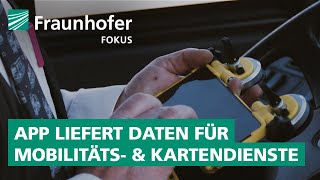
With the click on the play button an external video from www.youtube.com is loaded and started. Your data is possible transferred and stored to third party. Do not start the video if you disagree. Find more about the youtube privacy statement under the following link: https://policies.google.com/privacy

Eidos Road Glancr-App: Crowdsourcing app provides data for mobility and mapping services

The urban digital twin offers a unique, tried-and-tested platform for high-precision mapping, analysis, and simulation of urban road space and the mobility that takes place within it—in real-time, scalable, and interoperable.

  • Comprehensive recording of road space and mobility: Integration of a wide variety of data sources, including OEM crowd data and the innovative, AI-based Eidos Road Glancr-app for continuous, comprehensive, and data protection-compliant traffic space recording via smartphone.
    • Static recording (mobile mapping): Regular inventory of road space, e.g., lane layout, traffic sign register, road condition (ZEB)
    • Dynamic recording (monitoring): Traffic situation, construction sites, closures, parking space occupancy
  • Flexible, multimodal data fusion: Seamless merging and real-time analysis of sensor data from fleet vehicles (taxis, public transport, delivery services, etc.), stationary sensors, crowdsourcing apps, and cross-manufacturer vehicle data.
  • Innovative connectors: Standardized, interoperable real-time data layer enables easy connection and integration of a wide variety of urban data sources and digital twins.
  • AI-supported analysis & forecasting: Automated detection, evaluation, and prediction of changes in the road space (e.g., new construction sites, changed traffic signs, road damage, parking pressure, traffic flow).
  • Scenario simulation: Integration of simulation data for rare and critical events, e.g., traffic accidents or special situations.
  • Web-based, scalable visualization: Highly realistic, interactive 3D visualization of large amounts of spatial data – down to the vehicle level.
  • Cloud architecture & big data: Powerful and secure processing, storage, and analysis in modern cloud and database environments (e.g., MS Azure, PostgreSQL/PostGIS, Apache Accumulo).
  • Open standards & protocols: Support for modern interfaces and formats (HTTP/REST, MQTT, Kafka, JSON/GeoJSON, NGSI-LD) for maximum interoperability.

Advantages:

  • Comprehensive, lane-accurate recording of the dynamic road space and all relevant mobility processes – without expensive special hardware.
  • Quick to deploy, scalable, GDPR-compliant.
  • Enables data-driven control, monitoring, and optimization of urban mobility and infrastructure.